What is Electronic Chart Display and Information System (ECDIS)?
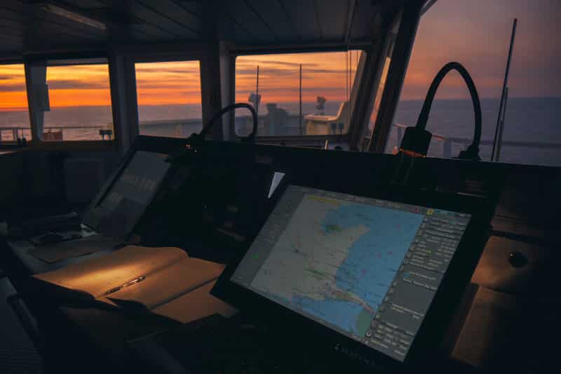
The Electronic Chart Display and Information System (ECDIS) is a development in the navigational chart system used in naval vessels and ships. With the use of the electronic chart system, it has become easier for a ship’s navigating crew to pinpoint locations and attain directions.
ECDIS complies with IMO Regulation V/19 & V/27 of SOLAS convention as amended, by displaying selected information from a System Electronic Navigational Chart (SENC). ECDIS equipment complying with SOLAS requirements can be used as an alternative to paper charts.
Besides enhancing navigational safety, ECDIS greatly eases the navigator’s workload with its automatic capabilities such as route planning, route monitoring, automatic ETA computation and ENC updating. In addition, ECDIS provides many other sophisticated navigation and safety features, including continuous data recording for later analysis.
The ECDIS utilises the feature of the Global Positioning System (GPS) to successfully pinpoint the navigational points. It also has to be noted that the ECDIS adheres to the stipulations set by the International Maritime Organisation, and thus it adds to the trustworthiness of the electronic chart system.
ECDIS is basically a navigational information system, interfaced with other navigational equipment such as the GPS, Gyro, RADAR, ARPA, Echo Sounder etc.
ECDIS also incorporates and displays information contained in other nautical publications such as Tide Tables and Sailing Directions and incorporates additional maritime information such as radar information, weather, ice conditions and automatic vessel identification.
Advantages of ECDIS over paper charts
- All information is processed and displayed in real-time
- It eases the process of passage planning
- One can get all necessary navigational information at a glance
- Alarms and indications are in place to indicate and highlight dangers
- Chart correction is made easier in ECDIS as compared to paper charts
- Charts can be tailored as per the requirement of the voyage
- Other navigational equipment such as the AIS, ARPA etc can be overlayed and integrated
- Charts can be oriented as per requirement
- With the facility to zoom in and out, features can be examined as per necessity
- One can obtain a more accurate ETA
- Charts can be interrogated for detailed information
- All in all, it enhances the safety of navigation
Types of ECDIS charts
- Raster Chart (RNC): RNCs are a direct copy or a scan of the paper charts. It looks identical to a paper chart as all the information shown is directly printed. The chart only grows larger or smaller as per the zooming and when rotated, everything rotates.
- Vector Chart (ENC): ENCs are computer-generated charts. The details on an ENC can be turned on and off depending on the requirement of the user. Objects on the ENC can be clicked for more details on the same. Depths can also be monitored to obtain a warning with regard to grounding. When zooming, the features grow large or small but the text remains the same.
ECDIS covered under the following
- SOLAS Chapter 5
- Port State Control Requirements
- IMO Performance Standards for ECDIS
- S 52 Standard (Display Standard)
- S 57 Standard (Compilation Standard)
- S 63 Standard (IHO Data Protection/Encryption Standard)
ENC (Electronic Navigational Chart) Layers
- Display Base (No information can be deleted)
- Standard Display
- Full Display
- Custom Display
Minimum Interface Requirement
- Position Sensor
- Heading Sensor
- Speed Sensor
ECDIS Compliance
- Approved ECDIS with approved backup
- Type approved hardware
- Type approved software
- Approved installation
- Official Chart Services
- Training of Officers
Chart Updating
Updates to the ECDIS charts may reach the ship in various ways, depending upon the capabilities of the service provider and the onboard communication facilities.
- On data distribution media (DVD)
- As an email attachment (SATCOM)
- As a broadcast message via SATCOM plus additional communication hardware
- As an internet download
Voyage Recording
- Minute by minute recording for the past 12 hours of the voyage
- Record of 4 hourly intervals of voyage track for a period of 6 months
Dual Fuel: Dual Fuel is the use of RNCs when ENCs are not available with approved paper chart backup.
Alarms and/or Indication in ECDIS
Alarms
- Exceeding cross-track limits
- Crossing selected safety contour
- Deviation from the route
- Critical Point Approach
- Different datum from the positioning system
Alarms or Indication
- Largest scale for alarm (present chart too small a scale)
- Area with special conditions
- Malfunction of ECDIS
Indication
- The chart over scale (zoomed too close)
- Larger scale ENC available
- Different reference units
- Route crosses safety contour
- Route crosses specific area activated for alarms
- System test failure
For ease of understanding, Indications may be either visual or audible whereas Alarms must be audible and may be visual as well.
Power Supply
- It should be possible to operate ECDIS and all equipment necessary for its normal functioning when supplied by an emergency source of electrical power
- Changing from one source of power supply to another or any interruption of supply for a period of upto 45 seconds should not require the equipment to be manually re-initialized
Carriage Requirement
- Passenger Vessels > 500 GT
New Build – By July 2012
Existing Build – By 2014 (Built before 1 July 2012) - Tankers > 3000 GT
New Build – By July 2012
Existing Build – By 2015 - Cargo Vessels > 10000 GT
New Build – By July 2013
Existing Build – By 2018 (Built before 1 July 2013) - Cargo Vessels > 3000 GT
New Build – By July 2014 - Cargo Vessels > 50000 GT
Existing Build – By 2016 - Cargo Vessels > 20000 GT
Existing Build – By 2017
Limitations of ECDIS
- The accuracy of the information received via AIS is only as good as the accuracy of the AIS information transmitted. The same is applicable for all other equipments interfaced with the ECDIS.
- Position of ships received on ECDIS display might not be referenced to WGS 84 datum
- Over-reliance on ECDIS for navigational safety should be avoided until it is confirmed that all the data transmitted, received and displayed are accurate
- Users must be aware that any erroneous information is detrimental to the safety of own as well as other vessels
- Some sensors might lack integrity with regard to accuracy and those that have not been tested
- Not all ships are fitted with ECDIS and hence one cannot be sure of technical ability with regard to positioning as well as navigation; the kind that ECDIS provides
It is never prudent for the OOW to depend solely on the information on the ECDIS. IT is only an aid to navigation and never replaces the human quotient which brings in the skill and expertise with experience that an ECDIS can never provide.
IMO Performance Standards for ECDIS
- The primary function of ECDIS is to contribute to safe navigation
- ECDIS with adequate backup arrangements may be accepted as complying with the up to date charts required by Regulation V/20 of the 1974 SOLAS Convention
- In addition to the general requirements for shipborne radio equipment forming part of the GMDSS and for electronics navigational aids contained in IMO Resolution A.694 (17), ECDIS should meet the requirements of this performance standard
- ECDIS should be capable of displaying all chart information necessary for safe and efficient navigation originated by and distributed on the authority of government authorized hydrographic offices
- ECDIS should facilitate simple and reliable updating of the electronic navigational chart
- ECDIS should reduce the navigational workload compared to using the paper chart. It should enable the mariner to execute in a convenient and timely manner all route planning, monitoring and positioning currently performed on paper charts. It should be capable of continuously plotting the ship’s position
- ECDIS should have at least the same reliability and availability of presentation as the paper chart published by the Government-authorized hydrographic offices.
- ECDIS should provide appropriate alarms or indications with respect to the information displayed or malfunction of the equipment
ECDIS Training
There are many institutes that conduct the ECDIS course. It is usually a 5 days extensive course for which candidates must have completed a year at sea as a Deck Cadet. Every institution has a different price range for the course and that must be checked on the institute’s website itself.
The institute must also be checked for approval from the respective governing body of a country (e.g. DG Shipping for India). With more and more ships inculcating ECDIS into their system, the knowledge, skill and understanding of ECDIS should be emphasized.
The same is achieved via simulators during the tenure of the course. Almost all institutes also put possession of a ROC ARPA certificate of proficiency as a prerequisite for entry into the ECDIS course.
The concept of ECDIS is something that is gaining more and more popularity in today’s times. By adopting this electronic system of marking and charting navigational routes, it has become easier to avoid any unwanted accidents as the ship is dependent on modern technology rather than humanitarian aid.
Inspite of some criticism from a few industry players, it can be easily said that ECDIS as an electronic Chart System is something that allows shipping companies and ship owners a lot of mental freedom when it comes to the safety of the vessel in the seawater by making ship navigation faster, simpler and sleeker.
Disclaimer: The authors’ views expressed in this article do not necessarily reflect the views of Marine Insight. Data and charts, if used, in the article have been sourced from available information and have not been authenticated by any statutory authority. The author and Marine Insight do not claim it to be accurate nor accept any responsibility for the same. The views constitute only the opinions and do not constitute any guidelines or recommendation on any course of action to be followed by the reader.
The article or images cannot be reproduced, copied, shared or used in any form without the permission of the author and Marine Insight.
Do you have info to share with us ? Suggest a correction

About Author
Shilavadra Bhattacharjee is a shipbroker with a background in commercial operations after having sailed onboard as a Third Officer. His interests primarily lie in the energy sector, books and travelling.
Latest Marine Navigation Articles You Would Like:
Subscribe To Our Newsletters
By subscribing, you agree to our Privacy Policy and may receive occasional deal communications; you can unsubscribe anytime.
Web Stories













Hi,
Appreciate if you could kindly advised me on how/where can I find sites for “ENC Symbols.”
Have a great day!
Need instructional training manual on gmdss and oow courses for vessel crew.
I will appreciate any assistance from your great marine college.
bonsoir j’ai besoin d’un cours sur l’ECDIS
MERCI pour toute aide
Thank you very much for the information . I have a question : how can a Pilot arriving on the bridge of a vessel for the first time immediately identify whether the ENC being used is an official chart?